Grand Ole Gravel: My Weekend Bike Tour from Boulder
Last summer, my main focus was on racing (Infinite Trails, Ouray 50 and UTMB), but I still dreamed of squeezing in one long solo trip on my bike. For better or worse, I figured the most opportune time to do so was the weekend following the Ouray 50. In addition, getting out for an overnighter with Abby, Tony and Hailey to test out the gear set up.
Given my usage of PTO in the few months prior, the trip had to fit into a Friday evening to Sunday evening timeframe; and by my own decree, the mileage should require most every minute of the weekend just to finish. I’ve done a lot of big days, but really never strung together a multi-day adventure at all, let alone on my own. Another goal was to explore my own backyard — specifically, to areas that are too far to reach from home in a single push. As such, I mapped a route (see here on Strava) that I could embark on right from my house in Boulder, getting out of work as early as I could to get a head start on the route Friday evening.

The planned route which was generally followed. Friday (green) would take me from Boulder to East Portal, Saturday (red) I would ride west of the Divide and North to near Cameron Pass, Sunday (blue) I would cross back to the east side of the Divide and head home.
I prepared my bike, a 2018 Salsa Warbird, with the necessary baggage and provisions for the tour on Thursday night, so it would be ready to embark at a moment’s notice. Using my race winnings (yay!) from the previous weekend’s Ouray 50, I was able to splurge on a ultra-lightweight sleeping setup: a Sea to Summit ultra-light bag and pad and an Ultimate Direction FK Bivy, which significantly reduced the load strapped onto my handlebars (Revelate system) from the mongo sleeping bag I had used on my test ride. For my top tube bag (Salsa Top Tube bag), I prioritized food, gloves, jackets, water filter — anything I might want access to while riding. The saddle bag (Timbuk2 Sonoma, not recommended) held everything else: pants, down coat, backup food, toiletries, etc. I made a planning spreadsheet of all the gear here.
I snuck out of work around 4pm and hustled right home to finalize my preparations and get to the important part — riding a bike! I pushed down on the pedals at 4:50pm with my fully loaded bike and set my sights on what in retrospect might have been the hardest climb of the route, especially considering the bike was as heavy as it would ever be. The gradual climb up Boulder Canyon changed sharply with the turn onto Chapman Drive and finishing up to the high point of Flagstaff Rd. My legs are beat, this is going to be terrible, I thought. Having just disposed of a hard climb, I still had several thousand feet of climbing remaining to get me to my planned bivvy spot at the base of Rollins Pass. Slowly crawling over 68J and the rollers of Magnolia Rd, I let myself ease up as much as I pleased. I dropped into Nederland, parked my bike outside the grocery store and helped myself to an unremarkable but pleasant canned dinner.

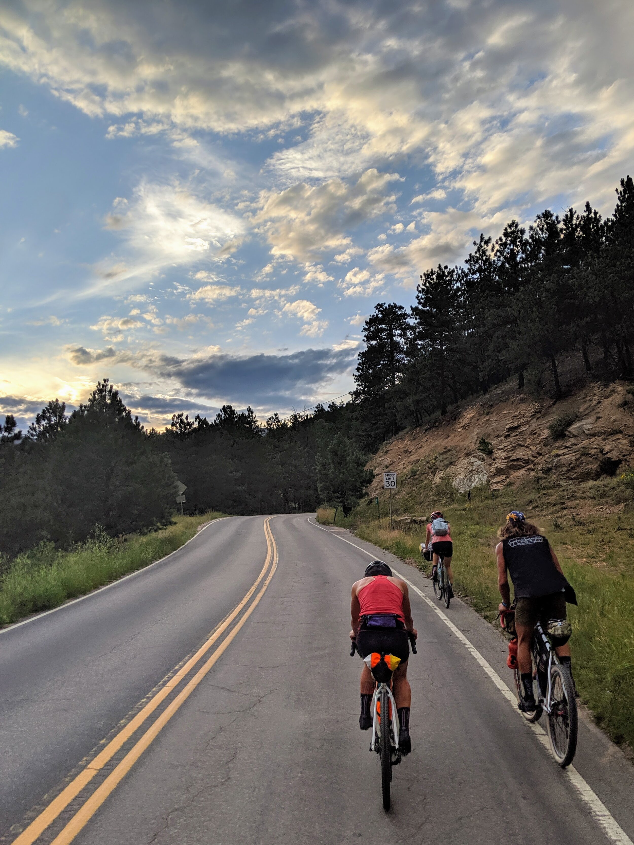
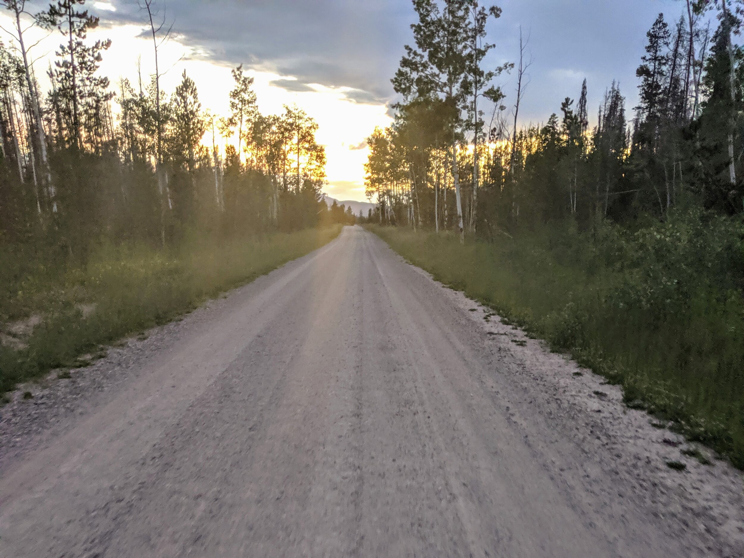
Sunset shot along Peak to Peak Highway just before the town of Rollinsville.
While pedaling away from Nederland on the Peak to Peak Highway, the sun dipped under the Continental Divide to the West. By the time I made my turn towards Rollins Pass, I was just following my headlight along the dirt road. Still an active route for trains, a rumbling giant split through silent night alongside me. At the end of the road before the pass in earnest begins, I found a dark nook of a campground I tucked myself into for the night. Day 0: 37 miles, 5 ,870ft of climbing, 4hr21min; Boulder to East Portal.

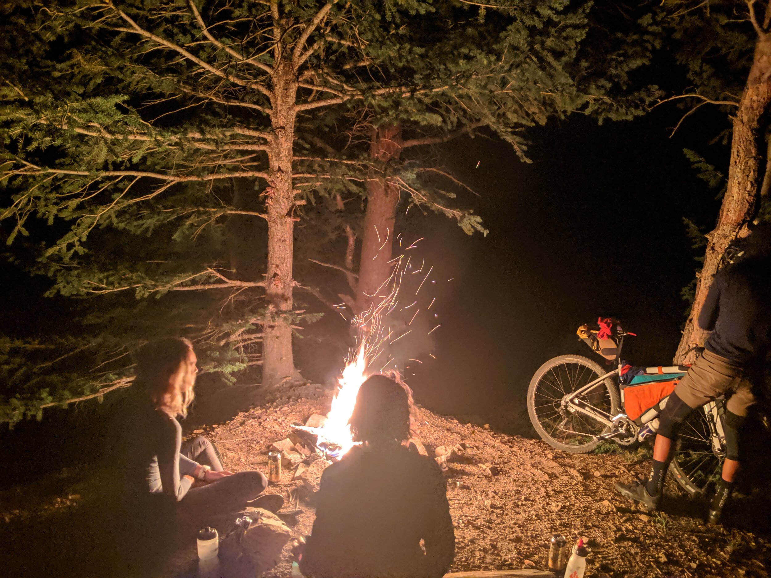
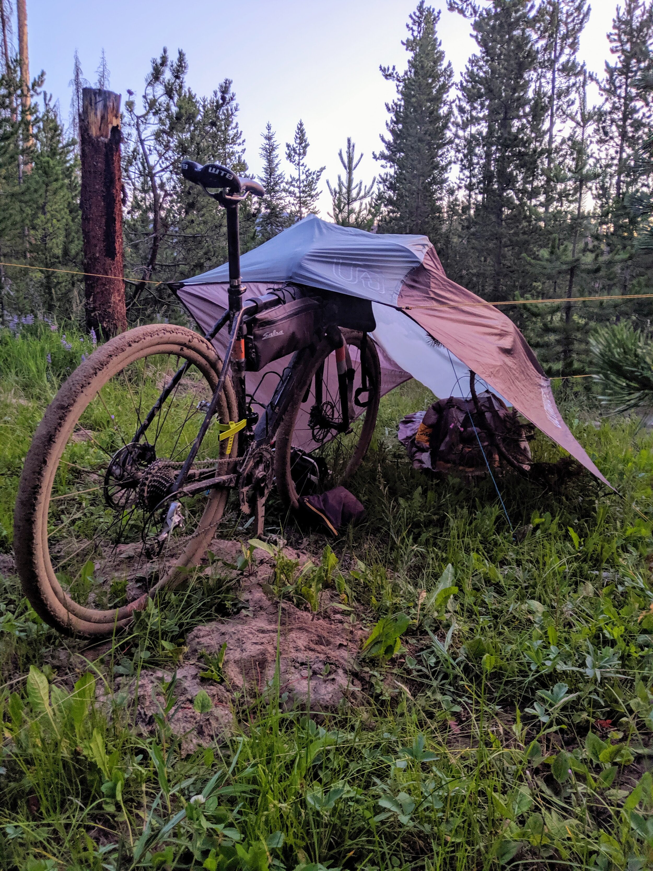
At my camping spot at the base of Rollins Pass. My whole sleeping setup (bivy, tarp, bag, pad) all fit into that little blue dry bag!
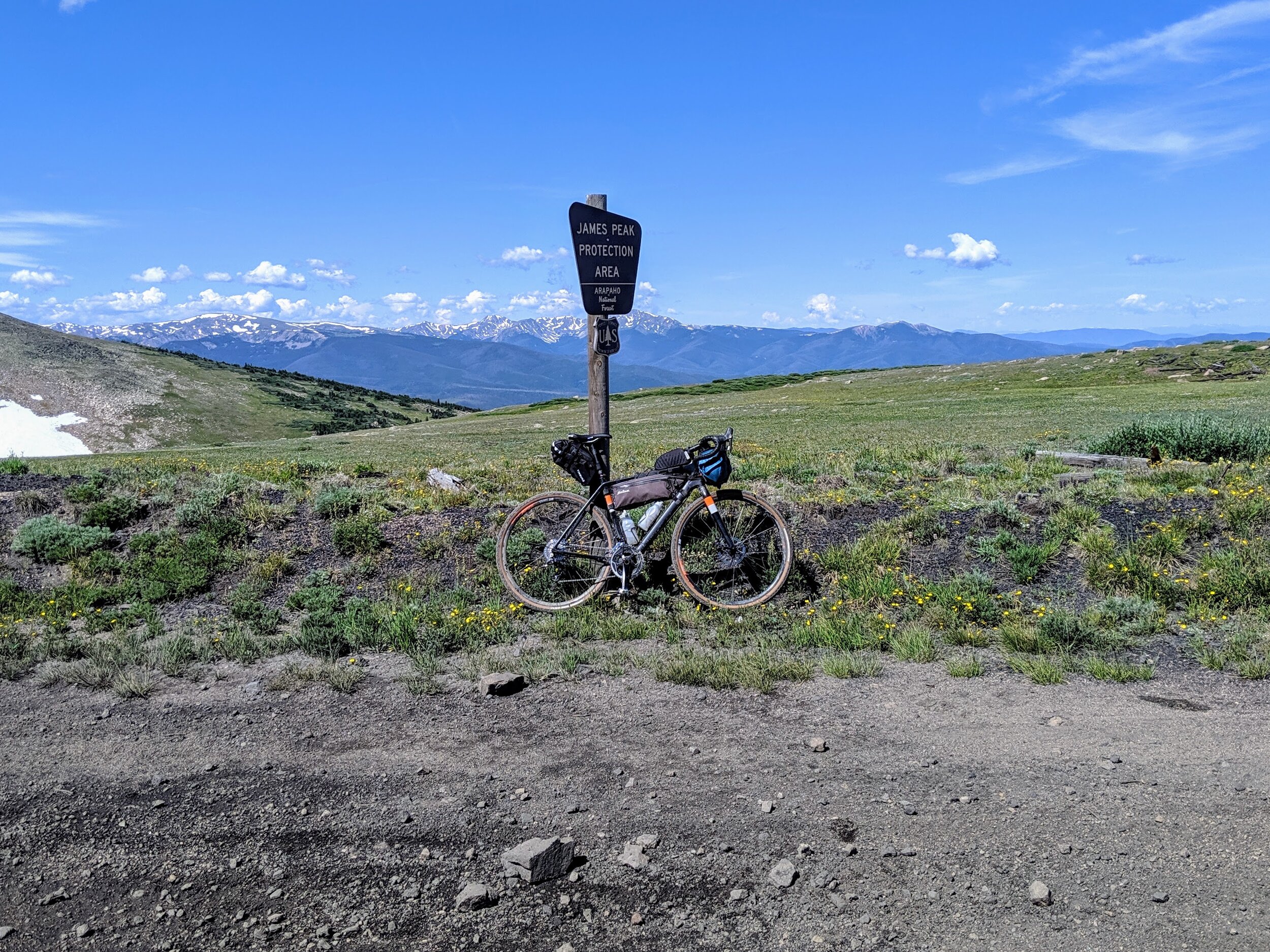
I awoke very well rested in the morning to the familiar voice of Ryan Smith and the tapping of footsteps. Somehow, I had slept for 10 hours, essentially laying in a ditch — maybe I wasn’t yet so recovered from last weekend’s race effort. Unable to evict myself from my nylon dwelling fast enough to greet the runners, I figured I would eventually meet up with the group on the pass. I wasn’t quite sure what to expect of the terrain getting over Rollins Pass on a loaded-down rigid bike. Some had said it was really bad, some had said not so bad, and then there was this picture found on the internet that ensured that it was entirely the rider’s problem, not the bike’s.
The road got progressively jumbly-er the higher I got, but it conveniently coincided with where I bumped into the RMR crew of Ryan, Cat, Tate and Kyle. I ended up pacing with Cat for a while as we continued to climb. The final bit of the pass was 100% hike-a-bike, but not so bad, maybe 20 minutes total and by far the prettiest hike-a-bike around. Parting ways from RMR, the descent down to Winter Park is on far more groomed dirt roads. Coasting down into Winter Park, I found a place to charge devices, cram in some calories and sip some coffee.
My excellent night’s sleep had offset my planned arrival time quite a bit, and with the remaining miles for the day I was concerned that my addition of Church Ranch Rd en route to Granby would be biting off too much. Heading out of town, I stumbled upon a Winter Park to Granby bike route, which of course seemed like a sign that I was making the right route choice. This path alternated from quiet road shoulders to wide, crushed gravel paths to single track. The finale drops you onto a service road in Granby Ranch ski resort. It ended up not being the fastest or flattest route — if I were to go back, I would take a hybrid route that skips the few singletrack sections, just because those sections are pretty slow, taxing and so winding that you aren’t really going anywhere.

Enjoying some nice gravel path on my way to Granby from Winter Park
The final push to Grand Lake was honest highway, with weekend traffic. But I found all the cars to be respectful of spacing and the views across the lake into Rocky Mountain National Park were tremendous. Whenever returning to pavement from rough trail, though, it’s always a welcome treat to really start clicking off miles. I was giddy about the next leg of the journey over Stillwater pass, but quickly realized that once I left Grand Lake, I wouldn’t see any food services for near 100 miles. I also didn’t want to push all the way into Grand Lake for an extra 20 mile out and back, so my food options were extremely limited for 4pm as a vegan. By some miracle, I found a black bean burger sans bun (bun had eggs) at the Roadhouse, which included typical burger toppings and a mess of fries. I double bagged it, rolled it up and smashed it into my saddle bag to save for a dinner down the road.

Lake Granby and the peaks of the Continental Divide in Rocky Mountain National Park across the water.
Stillwater Pass is the best dirt road I’ve ever ridden, hands down. Even with the crowds of 4-wheeler ATV’s and such kicking up dust, it’s truly perfect. If you have the opportunity to ride it on a weekday in late summer, take it — without the weekend cars it would be practically life changing. Smooth dirt, moderate gradient, beautiful scenery. The next link was connecting Highway 125 over to Teller Divide (also called Calamity Pass). I never made it to the highway though, as I got distracted by signs for Illinois Pass, which looked smooth enough for me and would cut out all of the highway miles — it seemed too good to be true!
It indeed was far too good to be true. I was able to ride maybe 30% of the trail after the initially smooth section became rutted, sandy and steep — and then it started raining. Trudging up over the pass I stopped at the top to enjoy my bag of black bean burger and fries while swatting mosquitos under a soft rain. I think this was the moment I was hoping for, getting out into the wild, embracing the elements and getting a bit beat down in the process. I felt my ego completely dismantle: I wasn’t so worried about the time, effort or style so much as just getting my bike and I to where I could sleep for the night. The sky began to darken as I started the ever so slightly rideable descent to connect with me to Teller Divide. Stubs of NFS road had me stopping to check the map every few minutes. I was committed to getting to my planned bivvy spot, so I pressed on. About a mile above the junction to the road, now on well established dirt roads versus singletrack, the light finally dwindled and I allowed myself to pull off the road, find a clearing and get some rest. Day 1: 93 miles, 9,040ft of climbing, 12hr22min; East Portal to Teller Divide Rd.
The morning began with a light breakfast of a Clif bar and some cookies Abby made that I’d stashed away until the moment called for it. In the cool morning air, I packed up my things and contemplated the remaining 130 miles back home. The good part, was that after two front-loaded passes (Calamity and Cameron) I would be cashing the climbs in for some easy and beautiful downhill miles. I was still over 50 miles away from the next legitimate town (no, Gould does not count), so I was motivated to not dawdle. On the West side of the Divide, the sun was muted by the mountains which kept the air chilly. I was thankful to be climbing immediately so as to try and stay warm.
Teller Divide, unlike the singletrack detour I took the night prior, was an extremely worthwhile detour from the main road. The dirt road felt like a double-wide Switzerland trail. The best resource I’ve found for determining if a road is of interest is searching for 4x4 YouTube videos. Usually, I can usually find somebody who made a time lapse of driving the entire road, so you have a good idea if it’s a pile of rocks or a nice dirt route. After passing through the ghost town of Teller City (complete with lots of moose wading in the scattered ponds on the sides of the road), there is one last punchy climb to the top. I gave in at the end for a short hike-a-bike.
Descending down the other side, I felt really excited. When I turned onto the pavement — oh, glorious pavement! — after many hard and slow dirt miles, I had officially turned the corner on my loop. More or less, my tires were now pointed towards home. I was also excited as I’d gotten to Cameron Pass early. A bottleneck for routing traffic back to the front range from weekends in the mountains, I wanted to disposing of the highway climb before the cars fully took over the road. The miles floated by on the smooth tarmac leading towards the summit. Yesterdays dusty trails and rain the night before turned my drive train to wreckage: each pedal stroke sounded like I was connecting to dial up internet or printing a receipt. The gentle grade of the pass finishes at 10,200ft with panoramic views of the Rawah Range to the North and the Never Summer range to South.
The remaining elevation profile home was encouraging, essentially downhill on mostly paved roads for another 90 to 100 miles. Anxious to keep moving towards my next food supply, I laid down into the drops and pressed on. I thought I’d eaten an okay breakfast, but I felt like I had practically no energy, barely pedaling to maintain my momentum. Normally, I can get by with a light breakfast and head out for a ride, but considering it was a meal 130 miles and 15,000ft into a 250 mile ride with 23,000ft, it was pretty pathetic. When I saw a camp store on the side of the road, I pulled over immediately.

A dirty bike disobeying a sign outside the camp store in Poudre Canyon.
I wolfed down a few cans of cold soup, a cold brew and some chips. I sat on a bench outside, my devices charging in an open outlet nearby. At first, I was head down. But by the time I stood up, I felt a renewed spirit (renewed caffeine stores, at the very least). Back on the bike I felt a lot better and focused on shifting my mood from despair to hope. Per my usual self-destructive habits on an adventure, I kept an eye out for detours for some added “fun”.
I toyed with the idea of going through Pilgree Canyon and Box Prairie instead of just Stove Prairie to Masonville. When I saw the Pilgree turnoff, I made a point to not let my legs and lungs have the final say. This was going to be fun, I thought — I’m going this way no matter what. Aside from the periodic car, the climb was really nice, alternating from hot and exposed to cool and shaded. When I thought I found my turn for Buckhorn Road, I couldn’t believe it was marked private. Of course, I was misreading the map and Buckhorn Road was still a few miles further down the road! I double checked with the minimal cell signal and battery I had and it seemed like best option was a 4x4 road just above, Old Flowers Road. It seemed to be my only option to keep moving East without trespassing, so I took it.
I could tell right from the start that Old Flowers was going to be bad. It looked rough from the start — extremely rutted out grooves, steep, punchy rolling terrain — and now, it was starting to rain. If there was any silver lining, it was that both me and my bicycle were already coated in dirt, so preserving any thread of cleanliness was a lost cause. What was concerning, though, was how slick the mud was getting. I tried to enjoy the most of it, but frustration can easily get the best of you in these situations. The culmination was slipping out on some downhill mud, flipping the bike over frontwards, with me still clipped in and now “trapped” beneath the bike and all its baggage, all the while my handlebars rotated 90-degress from my fork (i.e. turn the bars right to go straight). Cursing loudly as one can safely do on a random dirt road away in the mountains, I realized I was just acting like a petulant child – I was fine, just needed to adjust my mindset and right my bars on the fork.
My focus on the remainder of the ride down Old Flowers and connecting Stove Prairie to Masonville then became staying positive, which largely seemed dependent on slowing down and never letting myself get worked enough to feel desperate. This was also the result of being desperate, I couldn’t wait to get to the general store in Masonville, or home for that matter. A few months prior, Kyle and I had coasted into the same store, spirits destroyed after a fun winding road on the map turned into essentially glissading on two wheels (and some inadvertent trespassing). The store has all the essentials to resolve a bonk: fat, salt, sugar and caffeine. I chugged a Red Bull, wolfed down a family size bag of chips and filled my bottles with the sugariest Gatorade I could find.
One could theoretically take a lovely scenic route to Boulder from Masonville, but this was a better opportunity for the flattest, most well-paved and direct roads I could find. Despite waving my white flag and resigning to the easy route home, my biggest motivation was to get home. I settled into a groove in the drops. My normally crisp, fitted and clean black Adidas bike kit was now imprinted with mud, unzipped and flapping in the wind behind me, dust-caked legs baking under the open sky. In time, the familiar silhouette of the tiny jagged side profiles of the Flatirons and the Boulder skyline made themselves clear in the distance.
What I love about big adventures is returning from the far away to the familiar. Everything that was foreign and new suddenly returned to what I would run or ride in the evening after work. That same path a mile from home is the same path on this enormous weekend ride I did, and for some reason that seems oddly meaningful. Of course, what I was most excited for was seeing Abby (and all the work she had done on the house while I was on my weekend retreat — new kitchen backsplash, laundry room ceiling and wainscoting!) Day 2: 127 miles, 6,320ft of climbing, 10hr56min; Teller Divide to Boulder.

Ready for a hot shower at home!
I felt really happy and proud I finally got out for my long-term goal of a solo bike tour. I’d always been waiting for the ‘perfect’ opportunity, but I realized that would never present itself. I’m lucky to live close enough to incredible routes like this right from my bike shed, but I also believe that part of the beauty of bikes is that by exploring on two wheels, it gives – if not forces upon – one an appreciation of surroundings they would not have otherwise felt. No doubt running is no different (okay, running is even cooler!), but on a bike I was able to sustain a self-supported effort over an incredibly large timeframe and distance which was far more conducive to an immersive experience.