Unsupported Nüümü Poyo (John Muir Trail) Trip Report

Photo by Stephen Kersh
Driving west across the open desert in our trusted truck, I was holding the pedal at a smooth 80 mph. Cordis reflected aloud about a message his CEO at work delivered to the company, one that seemingly went straight through to my core.
“He said that it’s important we do things out of love, and not fear.”
I felt my gut surround this thought in flutters and somersaults. The year is 2020, a year so tightly hemmed in with fear, at times it seemed there might not be a path out.
It made sense that for the last month, all I’d been talking about was fear management. Avoiding pack rubbing. Not running out of food. Convincing myself the article I read about the guy in the Sierra who woke up with a mountain lion paw resting on his forehead was just a fluke. Not caving to sleep deprivation and serving as the lone voice of reason to tell myself my hallucinations were not reality. Not to mention, managing an actual medical emergency.
Or plain and simple, what if I missed Cordis and cozy beds so much I couldn’t even do it?
Out of love and not fear.
We drove through Death Valley at sunset and I felt a deep, steady flame of joy light me upright as we approached the Sierra, one of my favorite places on the planet.
This is what I love. This is what my brain fixates on when I’m not here in this exact moment, driving across Death Valley, about to jump off the edge of what my brain has thought is possible for me to do.
As we pulled into Lone Pine, the joy I felt in being here, about to start, was greater than the laundry list of fears 223 miles of solo, unsupported travel across the Sierra stirred up. Easy to say. Now, it was up to me to show that in my actions.
Nüümü Poyo: Names Matter
We pulled up to the Quality Inn in Lone Pine and I did a quick interview with Stephen and Ryan from Rabbitwolf who’d be joining us at the start and finish to make a video about my Nüümü Poyo (JMT) FKT attempt.
I explained how I was choosing to refer to the John Muir Trail as the Nüümü Poyo, the indigenous name for the centuries-old trade route translating to "the People’s Trail.” It is not lost on me that I’m benefitting from an experience on lands that were violently stolen from the indigenous people who were stewards for the Sierra for centuries before John Muir arrived. I hope to draw attention to this name so that others begin to recognize it interchangeably with the popular JMT label. Let’s popularize researching the lands we recreate on and referring to them by their names.
To learn more about the trail, I urge you to drink up the vast amounts of information and resources put out by organizations like Indigenous Women Hike. Their reclamation hike of the trail and sharing of the name that had been passed down through their elders was what inspired me to help spread their message. In particular, I wanted the circles I’m a part of, the trail running and FKT communities, to become more aware that naming and recognition matters. When we go to these places, we are guests.
IWH has put out a ton of resources I have learned a lot from. When you learn something from information they’ve made available, consider making a donation for the time they’ve spent educating you. I made a number of donations after this trip and thank these organizations for the information they’ve made available to folks like me who had previously been fed a diluted version of history. I’m far from an expert in this topic, but I hope that even simply referring to this experience by its indigenous name is a start in proper recognition.
Day 1: Into the Pit
I wanted to get a proper night’s sleep going into the stretch of sleep deprivation, so no wildly early morning for me. Plus, I knew the Whitney summit crowds would mostly be heading up in the early dawn hours making Whitney Portal and the starting miles a little less crowded.
It’s a good thing we told Stephen and Ryan we’d be downstairs by 7:15, otherwise I could have easily stalled for a while longer: I kept finding last minute pieces to tend to. (Like realizing I had no map of the trail downloaded on my phone, despite having paper maps in my pack and the GPX file on my watch.) I was stalling. I knew the weight of what was ahead.
I picked up my pack to head downstairs and truly guffawed at what it had amounted to. Maybe that’s for the best - there was no time left for gear deliberating.
Leaving the hotel room I looked around at a mess of bags and gear, realizing Cordis would be left to handle all of this in my absence. This was just a reminder of the path that had been cleared around me to head out. Though I was going unsupported, I had an immense amount of support around me to make it happen: a husband that would manage the logistics behind the scenes, a coach to help me meticulously prepare, a sponsor to support me in the build-up and pursuit of my goal and a job that allowed me to take the week off.
Stephen hopped in the truck with Cordis and I and we headed up the hill to Whitney Portal. I had some cashew milk yogurt with peanut butter, banana and granola out of a little paper coffee cup from the Quality Inn. The reality of what was about to happen started to sink in: it suddenly felt like everything was going so fast. Yet, I couldn’t wait to hit start on my watch. I knew I had to rip off the start like a band-aid and dive in.

Whitney Portal start. That’s a dense 22 pounds on my back. I look so clean!
We weighed my pack in at the trailhead scales and it came in around 22 pounds fully loaded with food, water, and everything else I’d need for the long journey ahead. I intentionally gave myself a wide berth because I wanted to cross every excuse on my list. I brought food for up to 6 days, extra layers, extra headlamps, extra everything. I wanted to feel like I had everything in my power to get it done — this wouldn’t be like 2016.
In 2016, I made a supported attempt on the trail and pulled the plug on day one. It was simply too much for me at the time. The mission was bound for failure with a lack of proper planning and preparation, but my dreams on this route had been brewing ever since.
After all of my planned races for the year were cancelled due to COVID, I was flying by the seat of my pants with big summer mountain objectives. After we had to pull the plug on a very special experience on the Pfiffner Traverse in July, I told my coach I wanted to do something longer and bigger, solo and unsupported. I wanted to see how far I could push myself on my own. It turns out with enough desperation and refreshing on the internet, anything is possible. I secured my permit exactly one month before my start date.
The weeks leading up were like I was cramming for an exam of a class I hadn’t even taken. I tested gear systems, did some overnights on the trail, did a quick taper, and drove out to California. The planning was done, the research was done and it was time to say goodbye. I knew I couldn’t yet fathom what was ahead.
I kissed Cordis and felt like I was diving off a high dive into a black pit I couldn’t see the bottom of. I started my watch and InReach Mini and started from Whitney Portal around 7:56am.
I quickly settled into the quiet rhythm of exactly what I’d be doing for the next 4 days, 11 hours and 20 minutes: putting one foot in front of the other. I didn’t hesitate to pause for a pack adjustment - there was quite a bit of that for at least the first day.
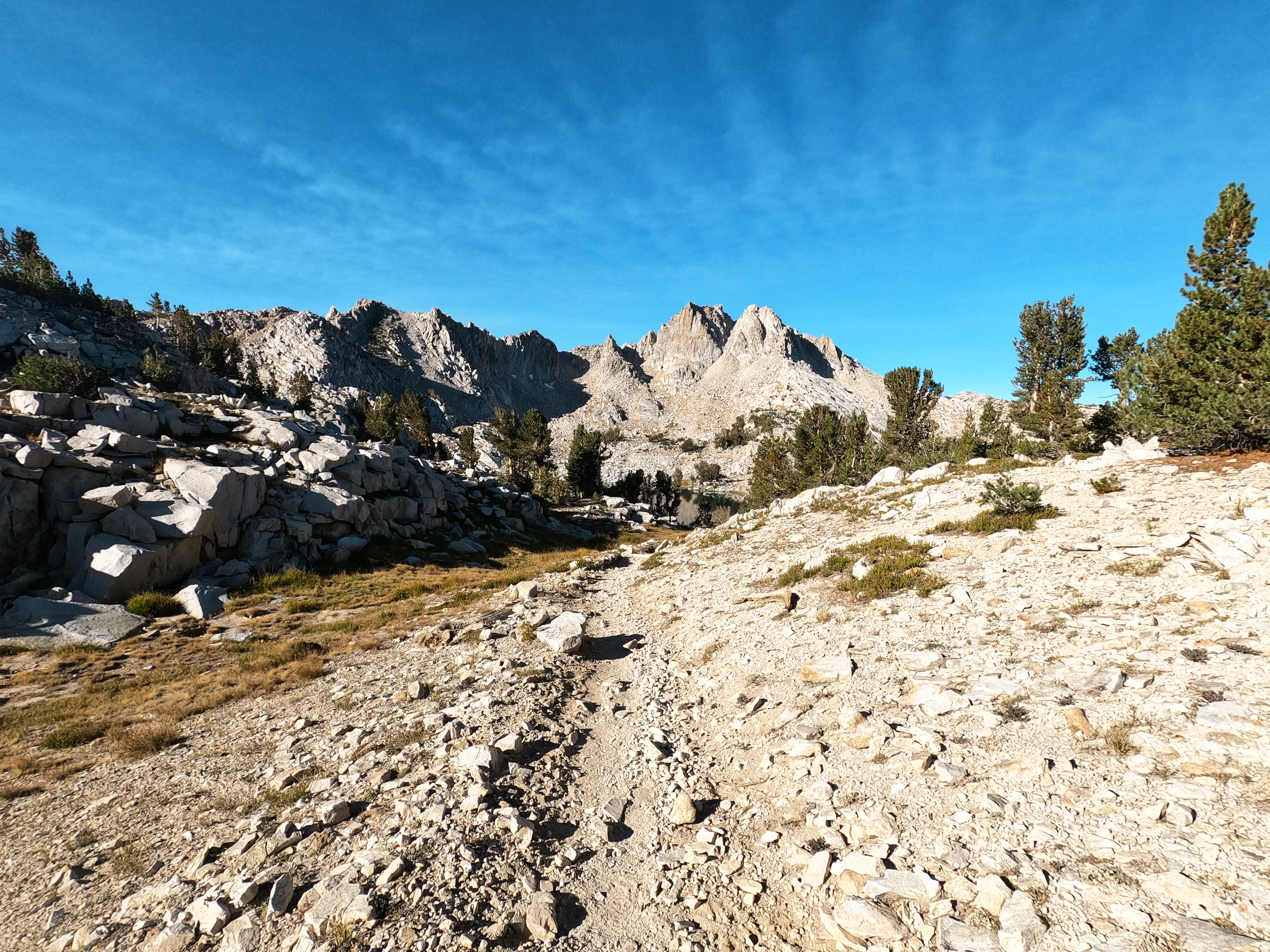
The smoke from the nearby Sequoia Complex Fire was a thin white haze in the air around me, but I couldn’t feel it in my body. The granite in the southern Sierra always startles me with its almost purple white balance. As I got higher, the sky sat against it in a familiarly deep ocean blue.
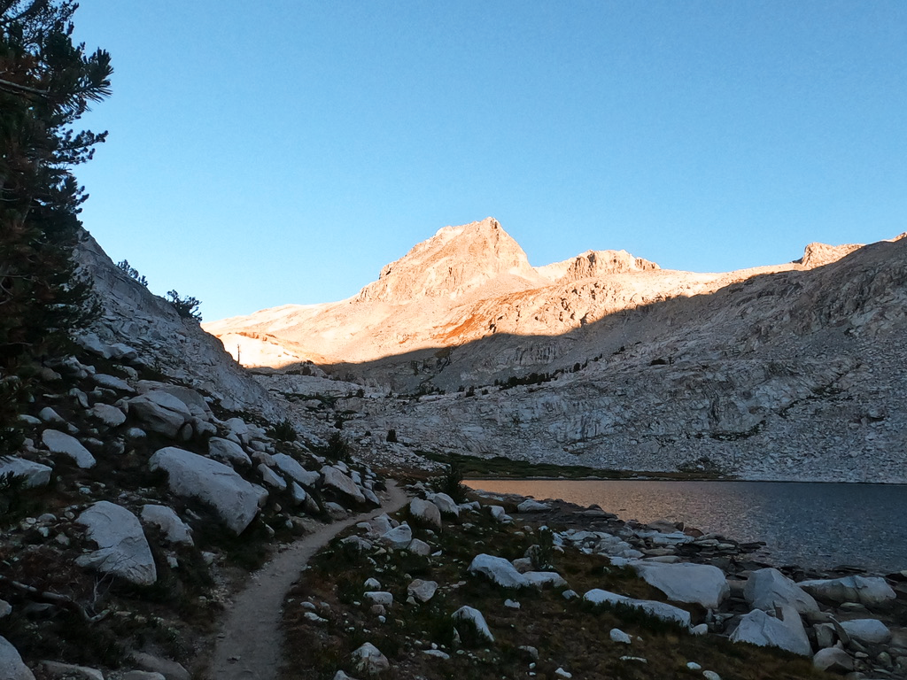
The route begins with a 6,500 foot climb up to the summit of Tumanguya, the Shoshone name for what is known as Mt. Whitney, the highest peak in the contiguous United States at 14,494 feet. While the John Muir Trail technically begins from the summit, FKT attempts are all tracked “pavement to pavement” from Whitney Portal to Happy Isles in Yosemite Valley.
Despite the fact that my body felt sturdy and well-prepared for the volume of miles, the gear effort was a cram. There were some simple realities to the fact that I’d only gotten my permit four weeks earlier: I had not yet used my pack yet, not even for one mile. I had not carried my full load. I had not even situated this full load in my pack until the morning of. So, I was gracious with myself. Any time I needed to stop for a quick adjustment, I didn’t hesitate.
It was only about 30 minutes in that I already saw what the pack issues ahead were going to be: the hard edge on the bottom of my rented Bearikade Weekender bear can was digging into the middle of my spine with every step. (The bear can is a requirement for any individual traveling overnight on the trail — no, my short trail naps and lack of established camps did not exclude me from this rule as it’s simply defined by “overnight travel”).
I stopped at Trail Crest and unloaded the entire contents of my pack to rearrange so that my down layer was at the bottom of the pack and slightly wrapped around the hard edge of the bear canister: not perfect, but doable.
As I hit the Trail Crest, I peered into Kings Canyon to see that it was far smokier. Not encouraging. I wondered about dropping my pack at the junction for the out-and-back to the summit, but decided not to in case for whatever reason that violated my chosen unsupported style: no desire to give that mental energy right now, just keep moving.
I arrived at the summit of Whitney in 4:38 elapsed, feeling a little more phased than I’d hoped and already significantly behind my planned split of 4:15. (I’d anticipated having to do a lot more “woah Nelly!” on this first climb and that was far from how I felt.) In hindsight, I give a bit more credit to the giardia and campylobacter I’d been diagnosed with the Thursday before starting. I’d just finished my last dose of antibiotics and I’m sure this had far more of an impact on my body than I realized at the time.

Getting the trail’s high point (14,494 feet) behind me early on.
I stopped for a few minutes at the summit to eat and take it in before heading out around 4:52 elapsed. I wrote “out of love and not fear” in the trail register, though it felt like a distant mantra at the moment.
Despite being a bit behind, I felt calm and settled in. Dropping down into Kings Canyon was a mental relief - I felt committed and far enough from Cordis that I wasn’t longing to be back at the start. The highest point of the route was now behind me.
The long, rocky switchbacks descending to Guitar Lake take you to a place far more isolated than Whitney which swarms with day hikers. I was very okay with this. I stopped for my first water filtering break of the day shortly before Guitar Lake, and spent around 10-15 minutes chugging a recovery/protein drink, filling everything and doing some pack shuffling. This put me in an excellent place, an effect that the Unived recovery drink consistently has on me.
I’d started to get some spring in my step, taking in the magnificence of the peaks around me, even though they were blanketed in smoke. I saw a few parties of hikers in this stretch, and asked each of them about the smoke conditions ahead. Consistently, they all remarked that it would get far better as I head north, especially beyond Forester Pass. This thrilled me!

Southern Sierra blanketed in smoke from the nearby Sequoia Complex Fire.
Day one of any northbound attempt is a doozie. The miles in this section to Forester Pass may win the award for most meandering, ambling and endless. (A tie with Lake Virginia to Devil’s Postpile, but I’ll get into that later.)
I saw a solo hiker who mentioned he was in the final days of finishing the JMT. I could tell he was sentimental. “Ahhh! I’m so jealous that you’re just starting!” This set the tone for something that rang true throughout — every trail user I saw was endlessly positive and stoked to be there, and that contagious attitude constantly overflowed to me, reminding me to be present and appreciative of where I was.
A dry section I’d anticipated was between Crabtree Meadows and Wallace Creek. I timed it well, but was thirsty by the time I got to Wallace Creek. (Extra thirsty from the dry, smoky air.) I chatted with a group of what seemed to be dads and sons, who had been section-hiking this over seven years. The weight of that quietly sunk in. What I was embarking on amounted to seven years of backpacking trips.
I don’t remember this section being quite so long last time, but I do remember that when I’d reached this point in 2016 I already knew the mission couldn’t continue past day 1. I took pride in this and continued steadily plugging away.
As the sun began to sit lower in the sky, I started crunching some numbers. What I hadn’t considered with my later start time was essentially how it squeezed more miles into a shorter amount of time, at least on the first day. Finally approaching the basin that contains the actual switchbacks of Forester Pass, I bundled up (all of my layers — it was feeling chilly and I knew I’d be heading back up to 13,000 feet) and also stopped for a 10-minute nap.
While it seemed early for a sleep (the sun had only just set), I was certain that I needed extra recovery time sooner than later. The smoke made day one even more brutal on the body and I felt it all adding up quickly. To set myself up for success, I needed some recovery sooner than planned, with the hope that I’d recover more efficiently in the higher air quality ahead.
I popped up after the 10-minute nap and decided it was time for some music, my favorite luxury I’d afforded myself in my heavy pack. I went straight for the sugar injection of the Eurovision Song Contest soundtrack, which fondly took me back to Pfiffner and the whole summer of massive mountain days Cordis and I shared together.
I was getting up the pass, but really I was already unraveling on Forester — sit breaks on rocks and staggering a bit on the trail in the early, sleepless night. However, in the moment I noticed that I was drawing no greater conclusion from it. There was no consideration for how this affected the miles ahead; I was simply not doing well at the moment. I wasn’t noting it at the time, but this strategy of mental compartmentalizing served me well the entire time.
Something switched on the summit of Forester: it switched and it never turned back the rest of the time. I’m not sure what it was exactly, maybe something like an unwavering commitment to the experience.

Summit of Forester Pass around midnight.
The Secret of Night
I felt so lucky that my permit’s start date was the beginning of the full moon, and looking out ahead I got my first real glimpse of what that would mean for my nights. The granite walls surrounding Vidette Meadows were lit up white with moonlight, each lake appearing out of the black basins only by sparkling glitter. The magic of it all was so utterly breathtaking that I became the most alive with energy that I had felt all day.
In my head, I felt like I was practically skipping down the descent: ABBA playing in my headphones, stopping to try and take a few night mode photos on my GoPro.As much as I appreciated the sporadic greetings of hikers by day, I loved the flow I could get into by myself with no one awake.
About 4.5 miles after Forester, I stopped for my planned sleep, abiding by my plan of early recovery. I slept for 1:50 here, subtracting my 10 minute nap from earlier from my allotted two hours for the night.
What I realized immediately from this first sleep was how much faffing around there was on either side of the nap. Filter water, mix a recovery drink to chug now and a cold-soak ramen for when I wake up, remove trash from the day and get it into the bear canister, put the bear canister away from where I’m sleeping, set out my sleep gear. And then upon waking up, it’s put in new contact lenses (I went with daily lenses for ease of use), put away my sleep setup, eat the cold soaked ramen, check in on my feet and socks, get my planned calories out from the bear canister for the day ahead, and filter some more water.
A fresh body might be able to do those tasks relatively quickly, but there’s a certain shaky-handedness that came as early as day one. I took note of this and thought on how I could avoid this overhead time the next night.
I started my watch back up again at 2:11am, headed for Glen Pass. (Most notably, I was heading for the exciting moment of walking by where I bailed in 2016!)
I walked by dozens of sets of glowing, green eyes, remembering how Cordis and I thought they were mountain lions when we were here together. I felt like some kind of local expert to know that they were all indeed deer, happily marching past them and chirping “hello!”. Tents popped up here and there, and their familiar shapes were comforting.
An observation about Glen Pass that applies to just about every pass on the Nüümü Poyo: a bulk of the vert comes in these long, preamble miles, and only the final thousand feet or so is in the form of actual switchbacks over the actual saddle. (In Colorado, our passes are a lot more direct and obvious — a few thousand feet and a couple miles of switchbacks.)

Climbing out of Vidette Meadows towards Glen Pass.
I saw a sign around 3:00am for a missing person in the area, which was rather eerie.
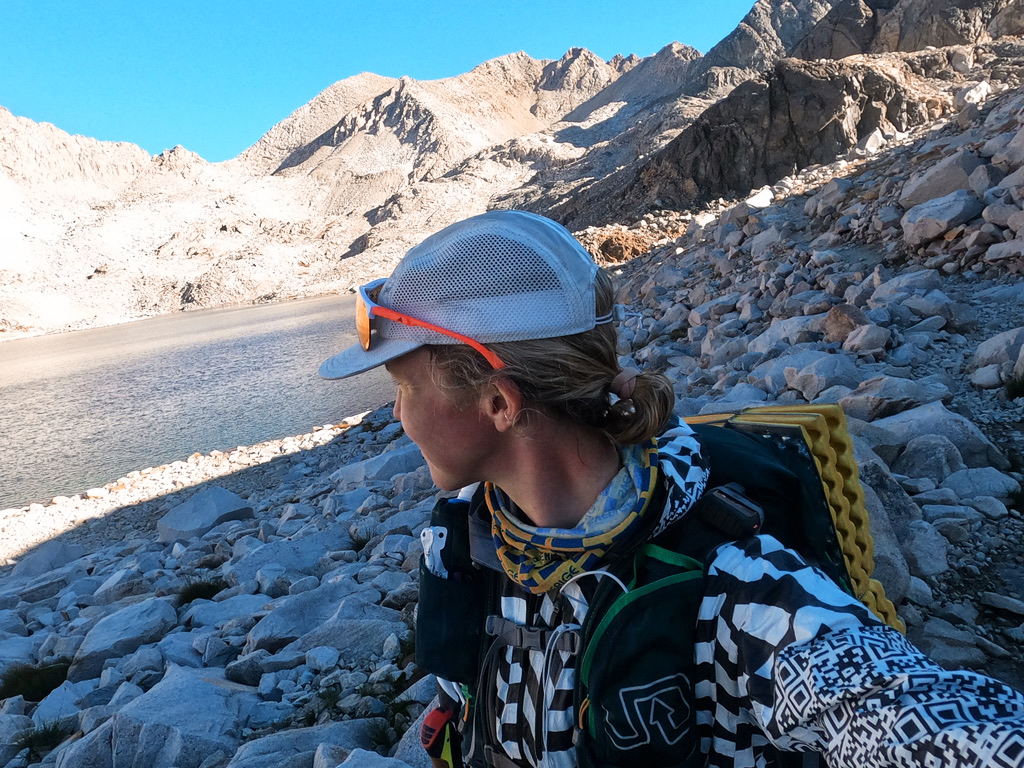
Even in the night, I could visually see the clear skies that were waiting ahead. I reached the summit of Glen Pass around civil twilight, and by true sunrise, I was at Rae Lakes filtering water and mixing a protein drink, surrounded by cozy tents and people waking up for the day. I made it through night one!

Rae Lakes at sunrise — the coldest hours I logged on the entire trail!
While I’d intended to be starting day two at the Woods Creek bridge (about 7 miles ahead), I remember that with my later start time, I was still a few hours away from “day one” being over. The staggered sleep time made me feel far from the record, but as the clock went, I was still right on it.
I wore my puffy coat for another hour or so — the Rae Lakes basin was my coldest memory on the trail! Shortly before the Woods Creek bridge, it was all layers off for a hot day ahead.
Day 2: Glen Pass to Muir Pass
I reached the Woods Creek bridge around 9:15am and was shocked to see how much this suspension bridge moves! Wild. No wonder it’s one person at a time on here.
The climbed up Pinchot Pass was very long and very hot — no other way to put it. Despite being back up at 12,000 feet, a few times I looked down and saw 95 degrees on my watch. I stopped and sent a couple messages on the InReach to Cordis and quickly received an encouraging one back from him. It motivated me to remember that he was watching my dot. Picturing him proud of me made me proud of myself.
Day two was…Sandwich Creme Day! I brought 18 with me — double-stuffed — and did a slow trickle of these throughout the day. (They’re just like Oreos, but from Whole Foods and calling them sandwich cremes instead makes me laugh.) I happily munched on these. The food was all going down just fine, even in the heat which was great.
There were a number of nice hikers in this section I stopped to chat with. Without fail, when they heard I was making a speed attempt, they’d go, “don’t let me keep you!” To which I’d always politely refuse and let them know how much I loved the boost of social energy.
I stopped under a tree for a 5-minute nap, which was a nice choice. It brought the pep back in my step as I made the final push up and over Pinchot. (Next time, it will be so helpful to have cues and markers of progress and actually know where all of these meandering passes lead to.)
I stopped at the top of the pass, feeling quite haggard. The weight of what was still ahead was baffling. Even as I write this now, I think of what a tough point in the journey it was. There’s nothing glamorous about being at mile 57 of 223.
I thought about what my friend Sabrina had texted me the day before I started: “After you reach a certain level of pain, it won't get worse. Then, just learn to love it.” Little did I know, things actually wouldn’t get much worse from here. In fact, they’d get better.
I was reeling from the heat as I descend Pinchot, and though I knew Mather was due north, I tried to make out which basin I’d head up next. In Colorado, most passes seem to have towns waiting on either side of them, or roads with campgrounds. It was bizarre to be on such a vast stretch of completely uninterrupted terrain.
I took a short break below Pinchot to clean myself up a bit which was deeply refreshing (mini bag of castille soap for the win). Getting back below treeline felt relieving — the sun reflects off the granite walls so much up high, that despite being lower, the forests feel way cooler.
I ran into some free-roaming horses, whinnying and grazing near the low point between Pinchot and Mather. I was surprised to watch how quickly the day transitioned to pre-sunset hours. The time was really flying.
The climb up towards Mather was gentle. I chatted with some campers who incredulously asked, “where are you headed?!” I kept my reply vague, “Up and over Mather!” They were shocked. I quickly learned that most of the backpackers really take pride in enjoying their camp setup, and many seem to call it a day in the late afternoon. Of course, this makes sense. But for where my brain was at the time, it felt a bit like being in a small town where every restaurant closed at 7pm. There’s still so much day left! I laugh about this, but really, it’s beautiful to see the mix of approaches and perspectives on this popular trail.
Shrinking My World
The preamble to Mather was a stretch I remember very fondly. I remember feeling incredibly present as the peaks turned hot pink, and open stretches of rocky land turned a faint, delicate purple. I started to feel such excitement deep in my gut for every turn that took me somewhere new.
Nutritionally, the afternoon was a blur of Tailwind and Spring Speednut gels, along with my remaining sandwich cremes. I was delighted that each time I’d reach for calories, there was an option that appealed. Not once do I remember losing my appetite or feeling nauseous. Throughout the entire journey, my calories were a steady trickle of around 250 every couple hours. I chose a slower cadence than I would for something less than 30 hours.

Sunset at the summit of Mather, one I think of often.
Reaching the summit of Mather, I took a few self-timer photos, which I only did a couple times the whole journey. This moment merited it. This break was a little indulgent, but moments like this made it so I never felt hurried. It was about consistently moving through it. Since most of this terrain was new to me, I never wanted to hesitate to pause and take it in.
I could have sworn I heard a voice say something, just below the summit.
Descending Mather, I wondered, is this the Golden Staircase? It’s rocky, but really more just like a pass at home in Colorado. The darker it got, the more jittery with excitement I felt, already recalling the night before with such joy. I felt like I was moving really well. Looking ahead, I saw the headlamps in the distance of hikers closing up camp for the night. A few beats later it seemed, I ran into a fellow trail user — the only headlamped traveler I ran into the entire time!
I opted to take my planned rest early again. It was barely 9pm when I found a nice big boulder to throw down my pad next to.
At the time, I wasn’t sure why exactly I was sleeping so early, but it just felt right so I went with it. Do it your way. From past overnights, I realized part of my gut instinct for sleep was really just a desire for a mental break after a massive day. My strategy was, rather than battle the inner voice that would beg all night, can I PLEASE take a nap now?, the nap is accomplished early in the night so there was no room for negotiating.
It was 11:52pm when I started my watch again — the break included my two-hour nap, plus 2x25 min faffing around with the aforementioned to-do’s. I was so paranoid of missing my alarm, I would set three in a row and keep the phone next to my ear in my down hood. I woke up multiple times in the middle of the nap, paranoid and making sure I hadn’t overslept.
As I started my night with a water filtering session, I decided to add my instant coffee packets to my chocolate protein drink to consolidate beverage needs. That went down easy! I kept repeating this from here on out and I swear, every time I’d make this drink it would go down in one long chug.
I couldn’t help but feel like I was in the same rhythm as the night before — summit the pass as the evening starts, stop for a nap, move through the low terrain at night.
I was delighted to open my Spotify and discover that I had a whole slew of Office Ladies podcast episodes saved! I instantly turned it up and loved the effect of having Jenna Fisher and Angela Kinsey babble away in my ears about my favorite TV show. It engaged me mentally and gave me the illusion of accompaniment.
I marched past the Palisade Lakes which were still turquoise in the moonlight. The moon was so bright, I barely needed a headlamp through this section.

Palisade Lakes sparkling blue in the moonlight. Pardon the blur, I didn’t realize until afterwards how much stability the night mode on GoPro required.
What looks like a bit of a straight shot on the map to the Middle Fork Kings River is actually quite dramatic in descent, but the miles were flowing almost effortlessly through here as I tuned in on babble about improv and Dwight Schrute-isms.
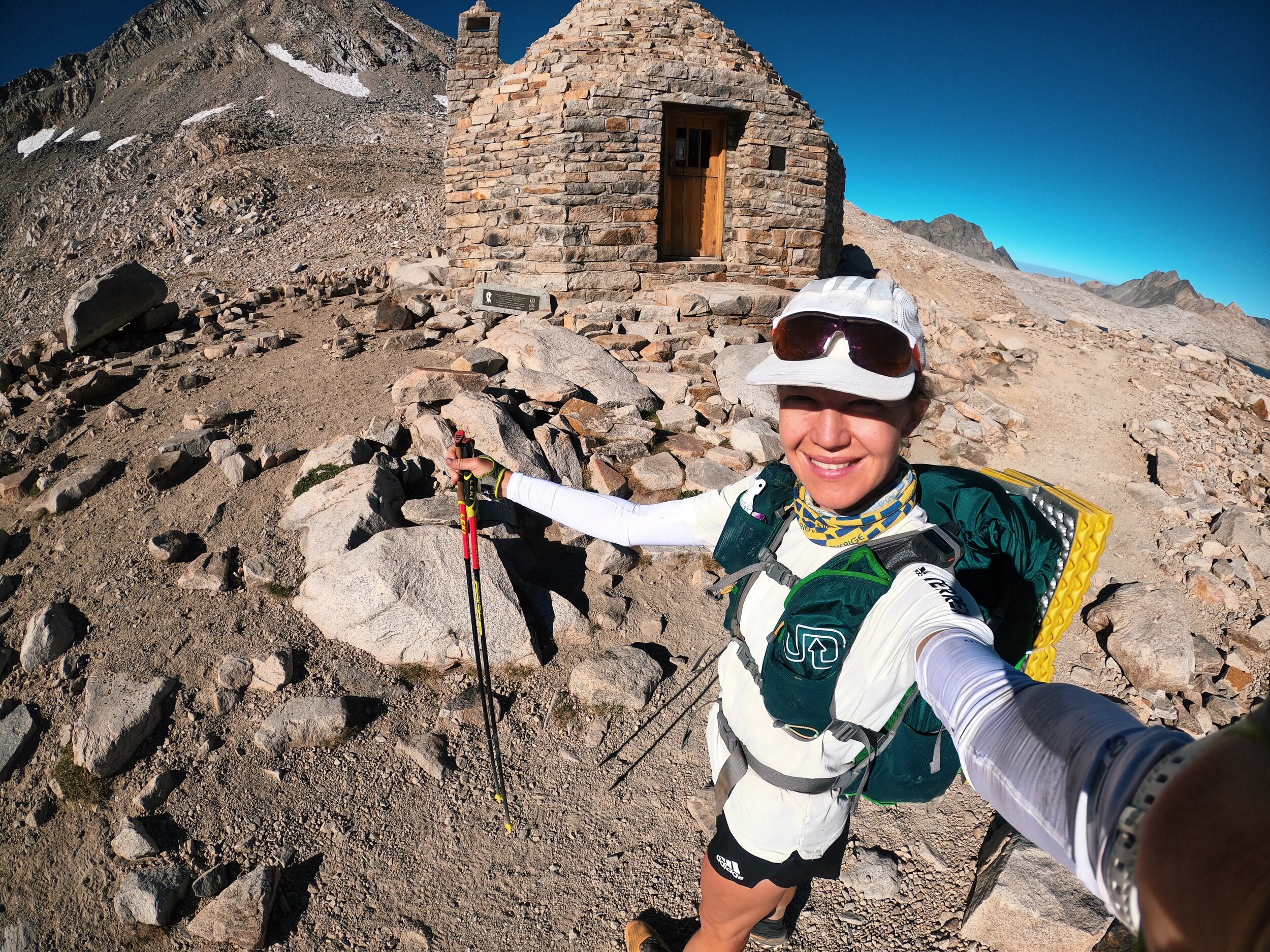
This night was the easiest one of the whole journey, and the sunrise surprised me as I broke treeline and topped out at Muir Pass around exactly 9am, feeling somewhat bright-eyed and energized. The hut was even lovelier than I realized, and this felt like a real milestone of the journey, around 91 miles in. I stopped to take a few selfies and felt yet another new level of thrill wash over me.
Day 3: Muir Pass to Silver Pass
This is a stretch where I felt like I was nearly bouncing down the trail in excitement. Somewhere in here was when I first realized that if I tightened my rest time and every split went as planned, I was still in touch with the record. This really motivated me and reminded me I was actually doing pretty okay.
I started to see my first trail-users of the day and enjoyed their energy and warm greetings as always. A common one was, “OMG, your pack is so tiny!” This always felt hilarious to me, as it was one of the biggest packs I’ve ever carried. There were so many wonderful people I wanted to stop and have conversations with, but I tried to keep these interactions brief, especially considering a tiny chunk of my brain at this point seemed to be solely devoted to getting me to stop and sit on rocks and rest.
It wasn’t long, however, until the gentle droning descent seemed to want to rock me to sleep. Even in the bright sunlight, my eyes felt like they were rolling around in my head struggling to stay with me. Rather than fight it for too long, I did what I did in the heat of the day on Pinchot and took a tiny 5-minute nap under a tree. Everything about these daytime naps was quick — unclasp the bungee around the pad on the outside of my pack, throw the pad on the ground, set multiple alarms on my phone within a minute of each other, turn phone volume up all the way, and keep my phone right near my head. Letting go, I’d roll into an instantaneous sleep. It was beautiful.
Popping back up was usually not too bad, simply because I knew I absolutely had to. This was a tension I’d battled with in the past — the tension of what my body wants versus the goal at hand. During the Pfiffner Traverse this summer, I was struggling to stay awake early in our overnight and Cordis said something like, “not giving into sleep is part of your commitment to the goal.” Framing it that way changed sleep deprivation, maybe forever, for me — you want to see how much I care about this goal? Let’s go. I can go for days.
The 5-minute naps were worth every penny — it was easy to burn twice as much time filtering water and mixing drinks. By allowing for an almost instantaneous response to my desire to nod off, I never really felt like I was depriving myself.
The hot day seemed to picked up right where it left off the day before, but I was grateful to be heading below treeline into the shade. This is where the days start to blur a bit, because the descent of Muir was timed similarly to my descent of Pinchot and both dip into basins before heading up the next pass. So if you ask me off-the-cuff, “on day three where were you?” It will take me a minute or so to answer. Is this really even day three? There’s not really days anymore so it doesn’t matter.
Marching past the McClure Meadows ranger station, I was surprised to see all of the COVID signage: “Do Not Approach Station.”
The Evolution Creek crossing took me a bit off guard. It seemed like the one, unanimous quality of other unsupported FKT attempts was this desire to soak feet in cold bodies of water. Everyone I read about did it, but that did not really sound good to me at all despite how hot I was. However, I didn’t really have a choice here, so I carefully peeled off socks and shoes, and upon reaching the other side, carefully patted the feet dry before covering them back up. Introducing water in any way felt like a massive risk on the blister-front. (I believe the one blister I finished with started here, despite how careful I was.)
Any time the scenery would change, I would become alert and energized as I remembered where I was. You are out here on the JMT right now. This is it! This is the thing you’ve been dreaming of!
Dropping down to where Evolution Creek hits the South Fork San Joaquin River, I felt laser-focused. The bear can had dug a pretty serious sore into my back by now and I considered just covering it in KT Tape. I’ll add that to my mental to-do list.
After crossing the bridge, it took me a second to get my bearings. The right turn didn’t quite make sense in person, but perhaps it was just my deteriorating brain. I listen to Cordis’ Nolans 2016 playlist I have saved on my phone. The songs always inspire me because they remind me of him and he inspires me.
I run into a group of guys who ask, “are you famous on Strava?” “No,” I reply, dead-pan. After walking away, I hear myself and think I sounded a little rude. I can’t seem to formulate what a friendlier response might have been. My brain circles on this for a while.
From here to the Piute Creek junction doesn’t seem to take too long, but remembering it was my planned night two rest, it feels absurd to think of having arrived here late in the night, as it’s now mid-afternoon.

Nearing the Piute Creek junction.
I’m a bit disoriented when I see a few folks walking in flip flops with no packs. I want to ask, where is your stuff? What are you up to? But then I remember Muir Trail Ranch is not far ahead. They must be thru-hikers commuting back to camp after enjoying a salad, Coke and a shower, or whatever it is their heart desired. A girl sits and sketches on a rock. Big smiles.
Hitting a Junction with such a direct access point to society feels exciting, even if I’m not turning that way.
Beginning the climb up Selden, I’m practically tripping over myself because my head is craned west, desperate to see if I can spot a road or cars that approach MTR. I’m not sure why it felt so fascinating to me. Maybe if I saw cars, I would remember that I’m not that far out there. I’m still here.

Switchbacks up Selden Pass that felt so baffling, I was concerned I might just be going back and forth on the same stretch of trail.
I remember my hallucinations really started here, perhaps because I was so desperate and curious to imagine what sorts of things might exist near this portal to society. I saw TV sets, cabins, tall exaggerated figures and faces. Cars, no — rocks. No, cars. Cars without roads? The area suddenly felt incredibly complex, a blur of industry and a trail through it all. The sun dipped into the lower half of the sky and massive redwoods began to surround me, the trail growing loamy and thick with red wood chips and mulch.
I realized I couldn’t quite remember my last water refill. McClure Meadows? The need for a refill suddenly felt a bit frantic. I ran into a couple on the trail; one of them had nice, purple hair.
“Any water opportunities ahead?”
“There’s a tiny trickle just around the bend, but it’s a little sketchy.”
That was all I needed. I found said trickle, mossy and muddy buried beneath some grasses. It was a very slow fill, but I took the time to chug a couple and fill a couple ‘for the road’.
The climb up Selden felt like it contained a baffling amount of switchbacks, and progress seemed so hopeless, I half-wondered if I was just going back and forth on a stretch of trail.
It topped out in an unexpected way — in a thick forest, where I was able to fill more water. I battled with a family of grouses. The trail wove between lakes and I saw families turning on lamps inside tents, brushing teeth. That type of evening felt so distant. Even though I had a chopped toothbrush with me and some dried dots of toothpaste, I felt now exempt from these norms, living in a world outside them.
I think I’d often confuse people around this time of night, maybe even worry some. I would usually try to compensate with an overenthusiastic greeting to assure them that I was “all good!” (“I’m great! How are you! Have a wonderful evening!”) Probably made me seem like even more of a creep.
Headlamp and down jacket were out for the night, and I was nodding off through the Sallie Keyes Lakes, weaving to the left and right across the width of the trail. Stopping for 30 seconds on a rock here, another 30 seconds there. It was time to bust out the Eurovision Song Contest soundtrack. I needed the hard stuff!
*Heyyy baby when you look at me, I know I’m in double trouble tonight.*
The opening line of this song felt like someone poured a bucket of cold water on my head. It felt so happy to listen to when it was Cordis and I driving the van around the San Juans or dancing in our kitchen. But suddenly it felt so loud it was a shock to the system — exactly what I needed.
I found it hilarious that after all of that meandering that began several thousand feet lower, the grand finale of the pass was really just a few hundred feet over a brief, rocky saddle. I stopped at the top of the pass for a brief, beautiful moment. Aimed my iPhone light in my face and took a couple of pictures, staring vacantly at the camera, trying to capture the gentle absurdity of this moment.

Summit of Selden Pass around 9pm.
I was so in it. It’s a feeling I miss as I type this.
*Why does it FEEEEEL like I’m the loneliest girl in the world, like there’s a dark other half of me, a part of me I can’t see, unless I’m looking in the mirror.* Demi knows what’s up.
This beautiful, delirious space between euphoria and reality was addicting. The lakes were white with moonlight, everyone was asleep, and now it was just me and the trail. This high above treeline, I realized I could sing as loud as I wanted, so I did, trotting down the backside of the pass giddy to have Selden behind me.
These highs would wear off quickly, so I had to take them while I could. I’d grown accustomed to my early evening nap, so that’s what I did. As soon as I found a flowing water source (everything had become quite dry in this section), I pulled off — somewhere near the Rose and Sandpiper Lakes trail junctions. (Being near water was an important part of making these stops efficient and getting my chores in.)
I was now in quite the groove with these naps. My little plastic emergency bivvy was really starting to feel like an honest shelter from the long, endless stretches of trail.
Cold soaks of the ramen were feeling a bit time consuming. I realize this sounds ridiculous given that I would still take a break to sit on a rock for 30 seconds, but the clock was ticking and I wasn’t in the mood to waste time fumbling with things.
This nap was about an hour and forty minutes, and coincidentally, was timed just right to wake up upon moonrise. Upon waking, I chugged my absolutely delectable blend of instant coffee and chocolate protein powder. I got a blend of gels and ramen accessible for the day ahead.
Bear Ridge was a bump I’d been warned about, and it was eerie in the now fully risen moon. After the climb, there was a longer flat plateau before descending. For whatever reason, it felt like an empty campground. In my brain, this was a campground I was merely electing to not pull off at.
While the night before had been all about Office Ladies, I’d really exhausted my set of downloaded episodes. Buried in Spotify, I found a Rich Roll interview with Rebecca Rusch I’d downloaded ages ago. I turned it on and was enveloped in Rebecca’s stories of Vietnam and long cycling journeys. I found comfort picturing someone like Rebecca getting a kick out of what I was in the midst of as I listened. I felt proud of myself.
Descending Bear Ridge, while on a map looked like a casual bop down to a river, was a larger-than-expected drop to an absolutely roaring Mono Creek. I remember it feeling loud with power and bright with moonlight.
Shortly after crossing the creek, I took a 10-minute nap. Upon waking up, I was disoriented and actually turned back the wrong way on the trail. I went for about a half mile before checking my maps and realizing my error. I think the switchbacks descending Bear Ridge had messed with my sense of direction.
After this, I made a new rule that for any nap, I would make an arrow on the trail with my LEKI poles showing the direction of travel. It was an odd feeling, catching my brain make such an obvious mistake. This was the beginning of a deeper chapter of mind games that was beginning.
As the climb up Silver became more steep, the sun began to rise and I turned on M83. It was a powerful soundtrack to the moment and I moved well up this 3,000 foot climb. About halfway up, the trail threads the needle over an unexpected saddle — classic JMT travel, with the plot-twist passes!
I felt that getting to the top of Silver would be the beginning of the end, which is hilarious to write now. There were still 83 miles to go from the top of Silver.
Day 4: Silver Pass to Lyell Canyon
I took some photos and felt proud and happy, just how I remember myself out there. Around this time, I realized I had about 1% battery left on the tracker. I didn’t really care too much about it, though. I was now entering areas where there would be cell reception from time to time, so I’d have that access to messaging if needed. (I apologize to everyone following along who did NOT feel as relaxed about this as I did! Thank you, Cordis for being very relaxed about not hearing from me for a good 30 hours or so.)
The views of Chief Lake in the morning light were some of my favorite views I remember on the whole trail — brilliant turquoise, and the classic sandy white color of the trail. I can see it now.
As I descended, the heat was really picking up quite early in the day and I felt like I was craving something salty and crunchy. I tore into a Ramen packet dry and started crunching away, amazed at how good it was unsoaked! I made sure to chase it with a good amount of fluid, knowing it would take a bit more to digest.
I started seeing many more people through here as I approached Lake Virginia. For the first time the whole way, it seemed I was seeing day hikers from Mammoth, and not necessarily just JMT-ers. The energy of the day hikers seemed so bright and bubbly.
On the switchbacks up to Lake Virginia, my watch read 97 degrees. It was really, really hot. The trail was still and exposed and I was in the pain cave. Still, the hikers around me were relentlessly happy — so much so, that it was entertaining.
“Beautiful day! How are you doing there, today?!”
“Well to be honest, I’ve been better.” I muttered, with dull consonants. Why did my voice sound so weird?
“Never a bad day on this trail though! Am I right! Have a great one!”
The contrast in energy was hilarious and once again, these folks reminded me of the staggering beauty of where I was. It was so special to be here. Lake Virginia surprised me with its massive size and was the first lake I felt like dunking myself into. I knew that was a luxury I couldn’t quite afford at the moment. My rock sit-breaks were my preferred form of indulgence. I also didn’t want to risk wet feet creating a hotspot or blister. As a pleasant alternative, I made a huge Tailwind in my 1L bottle. Nice.
The 16 miles or so following Lake Virginia were some of the most relentless of the whole experience. Descending to Purple Lake, I cried for the first time. I think it was because I felt so close to civilization — probably only a handful of miles away from where Cordis was staying! I felt so close, but still so far away knowing how many miles remained.
“Maybe in a million miles, on the highway through the skies, someday soon we'll be together”
That’s exactly how it felt, kicking down that dusty trail in the near-100 degree temps. Maybe in a million miles.
Logistically, the next stretch became one of the driest and I went many miles without water, nursing my 1L Tailwind as conservatively as I could. The miles droned and my pace dropped. My white arm sleeves, white shirt and white cap reflected the heat back the best they could. Keeping my skin out of the sun was critical.
A guy on the trail asked something weird like, “I’m guessing you’re with a guy who’s up ahead?” Blankly, I replied, “uh, no.”
I was starting to feel a real divide between my world and reality, like there was a glass wall between and I was a ghost watching the real world around me. I pictured getting to Yosemite the next day, in time to sleep in the tent cabin Cordis and I had reserved in Curry Village. It felt like fiction I couldn’t access.
The trail started making these great big sweeping U’s around the hills. I put one foot in front of the other. A nice group of thru-hikers said, “there’s water not far ahead!” It reminded me to stay present and remember that this, too, would pass. I loaded on fluids at the creek with a renewed sense of purpose. Devil’s Postpile was happening. Night was not far away. And remember? You love night!
Near Red’s Meadow, I thought of camping there with Cordis and my parents, enjoying the reserved cabin in 2016 a couple nights after I’d bailed. There’s no way I could have gotten to where I was now in 2016, even with support. I felt so proud walking by Red’s Meadow. I thought of what it would look like right now if I were supported — I could have had a crew waiting here for me to guide me through the confusing network of trail, maybe a cold Coke. I’ve even heard of some taking a quick hot shower. I could throw on a fresh kit for the next day, and a pick up a pacer to chat with my whole way to Yosemite. But what I was looking for this moment right here, the hot and dusty one where I had no one to look to but myself. Where I got myself through it again and again and walked right past where I could have turned off to buy a Coke. The quiet moments of strength where no one was watching. This is where strength took new root for me. Roots in a new, deep place that aren’t going anywhere.

Dead tracker means you start taking timestamped photos by specific geographic markers in case you get the record.
It was now clear that I was going to complete this unsupported. The record, however, was dangerously close. Every time I added up my A-splits, they added up to be exactly the record time. I knew it was going to be close. So I made a commitment to myself to put the lows of the Mammoth section behind me, and go hard and fearlessly into night four.
Go hard, I did. I had a gradual, ambling 6,000 foot climb ahead of me. The splits in my head were Donohue by 1:30am, and Tuolumne by sunrise. I kept running the math in my head and it just barely worked. Besides hitting A-splits, the other stipulation was that I had to skip sleep entirely.
Just before Johnston Meadow, I lost the trail and found myself thrashing through the trees and crossing a river. It was a result of the odd combination of my unwavering, brute force and growingly unsound brain. I marched back up the slope and found the trail, unsure of how I’d missed it in the first place. This was starting to happen more and more frequently, my sane brain catching the other half going off the rails.
As the sun set, my pace felt almost out of control. I was charging with aggression and focused full-throttle on the record. I climbed the first section of the climb not far off the pace I might do Green Mountain in at home, but I was 175 miles in with a pack on my back that at this point still weighed around 18 pounds. Pulling my headlamp out, I felt absolutely charged with energy. There was one night remaining of this great journey and I was hellbent on making it count. This was the buzzer shot, the bell lap.
At the first of many junctions in this lake-heavy area, I started to become extremely doubtful about my sense of direction. Trinity, Rosalie, Shadow — the lakes were one after the other, difficult to distinguish from one another. I kept pulling out my phone to verify my location against the map I had downloaded. Paranoid, I’d repeat it again and again. The turn for Shadow Lake felt unexpected, and I bargained with myself that if I took a 10-minute nap, my decision-making skills would improve. I took a 10-minute nap, crunched on some dry ramen when I woke and kept moving with significantly restored energy levels.
Recklessly Fearless
As I was climbing out of Shadow Lake towards Garnet Lake, I began to smell smoke. But it wasn’t that low-AQI, regional smoke those in the west know well. It was the sharp smell of a very specific, local campfire. I assumed it was campers who thought they wouldn’t get caught so late at night having an illegal campfire. I was pissed off, all geared up to yell at them. Adrenaline pumping, I expected to come around the corner and see some idiots drinking beer. I saw the orange glow of flames and yelled an aggressive, “HEY!”
No response. Getting closer, I realized that the fire wasn’t along the trail, but on the side of a steep slope. The glow of the fire lit this part of the forest and no one was in sight. This was a straight up wildfire!
Without thinking twice, I marched up to the fire and started stomping it out with my feet. I dug with my shoes to get to the source, kicking and stomping at the embers. As I dug in the dirt, more tiny embers appeared. It seemed to actually be coming from the root tree of the system. I spent several minutes there stopping the burn the best I could, then got back to it on the trail.
Leaving the smell of smoke behind, I was satisfied that I located and stomped out what could have become another raging wildfire of the west. I felt strangely fearless and ready to handle anything that came my way. I felt so connected to the trail, it felt like my duty to do everything I could to defend it.
The lakes seemed to crescendo one after the other as I arrived at Garnet Lake, grand in the moonlight. After Garnet, lakes like Ruby Lake and Emerald Lake felt like small tarns. I told myself I could take a small pause at the edge of Thousand Island.
As I approached Thousand Island, my headlamp caught the reflective materials and zippers of tents scattered along its south shore. There are many of spots along the JMT that are iconic, but this area is certainly among the top for which the trail is known. Many might have felt bad for me that I wasn’t there by light of day. But in the light of the full moon, Banner Peak was dramatically illuminated and the lake was glimmering. These moments were a hit of caffeine on their own, a gel for my soul.

Thousand Island lake was still as glorious in the moonlight as I can imagine it might be by daylight!
I decided to commemorate the moment with a self-timer photo. At some point after the fire, I’d put on Infected Mushroom in my headphones to help me stay awake and to be honest, I was in an entire other world. The next stretch is referred to as Island Pass, but it didn’t feel like a pass to me. It was a bit of a blur. I remember it rambling on and starting to feel like a strange land of puddle-like lakes and green mounds of grass. It was bizarrely open.
At a bend in the trail around mile 180, I yanked my sleeping pad off the back of my pack. In my haste, I laid in the middle of the trail and set an alarm for 10 minutes. No covering on me, just my bare legs half on the mat, half in the dirt.
I had around 40 miles to go, a number that sounds large, but in the moment I felt like I was in my final push and could let things fall to the wayside like covering myself when I napped. I know there was another 4-minute nap in here somewhere, but I actually don’t recall when or where it was.
Having Pink Nightmares
It was around 2am. I was behind my target of Donohue by 1:30, but it was hard to know how much was ahead until I summited.
As I climbed, the trees around me became long, gaunt people like Giacometti sculptures, all about 15-30 feet tall with startling expressions on their faces like nothing I’d ever seen before. The moonlight was so bright, everything around me was either darkness or startlingly bright like a black and white movie.
I remember hearing the song ‘Having Pink Nightmares’, a song that gives me an eerie chill when I think back to this moment. (So does the album art on its own.)
Keeping you sane and you fade away
Just enough, you felt the edge again
Hugging six rabbits and having pink nightmares.
It was around this time that I saw a curious light at the horizon, maybe a half mile ahead of me on the trail. Finally! I thought to myself. Fellow night travelers! I knew I’d see some fellow trail users during the nighttime eventually. Maybe even another FKT attempt, or some PCTers wanting to hike during the full moon.
A few minutes later, I saw that the light was actually not on the trail but was something low in the sky. What was bizarre was how quickly it had risen into the sky from the horizon — it was not a rising star or planet, but seemed to be some sort of aircraft that had a brightness and proximity able to be mistaken with a headlamp.
I suddenly snapped out of my hazy hallucinations and became highly alert of my surroundings. I stopped on a rock to better observe what I was seeing and to also judge the light’s movements against a rock or something fixed. I sat here for a while, it may have been around 5-10 minutes. Had this been a half hour earlier, I would have been dying for even a 60-second nap. But now I was alert and monitoring what seemed to be a bit of a situation.
The light seemed to be moving like a spotlight that was searching for something, to the left and right, then up and down. It’s entire position was shifting in a curious way, too. It almost seemed to be bobbing. I remember positioning my viewpoint so that a nearby rock would block the light out of sight. Then, I would watch as the light would quickly rise up.
Very decisively, I came to the conclusion that I did not want to be spotted by this light. However, I knew I needed to keep moving and get the pass behind me. So I committed to turning off all light on me so that I wouldn’t be seen. Yes, this means I turned off my headlamp for the entire way up and over Donohue Pass in the middle of the night.
As I left treeline behind me, I was fixated on the strangeness of what I was seeing so vividly in the open sky above me. Now that I had a better position, it seemed that there were two other lights in line with this one, except the other two were receding further away. The light directly above me seemed to be very keyed into this specific basin south of Donohue Peak. I knew that SpaceX was often experimenting out of Southern California, and was very open to the fact that what I was seeing could be some sort of government aircraft or safe presence.
However, I also knew that I definitely didn’t NOT believe in alien abductions and thought: if there’s even a 1% chance that could happen, is this not the perfect setup for something like that? A lone female on a high mountain pass in the dead of the night with no one watching.
Despite the bright moonlight, it was difficult to make out the cairned direction of travel on the rocky pass without light. As I climbed higher, the light seemed to have moved directly overhead. I was back to charging, determined to finish the pass off and get low again where it felt safer.
The earliest medium blues of daylight were gracing the eastern edge of sky as I reached the summit. As I descended, the light seemed to get higher in the sky to maintain vantage of me. I even stopped behind a rock, and watched it shoot up to see me behind the rock.
Whatever was happening, I suddenly felt safer as the sky grew pink and as trees began to appear again alongside the trail.
I filled my bottles at a creek, relieved night four was finally behind me.
Lyell Canyon to Happy Isles
I turned one last time to watch as the familiar light still hovered above the crest of Donohue. It was now rising back up into the sky and was the last I saw of it. I could finally laugh a little about how bizarre it was now that I felt safe. I turned on the GoPro and recorded some thoughts out loud as I marched down the trail, bottles full of fresh Tailwind.
I felt a gritty pride with night four behind me. I was still bundled in my pink puffy as my core temp was steadily low at this point, crunching on dry ramen and talking to myself. I felt fresh — today was the day I was going to finish the John Muir Trail! It was all eyes ahead to Happy Isles.
The Lyell Canyon trail was fictitiously buttery single track, ever-so-gently descending. I waved to campers waking up along the Lyell Fork. “Good morning!” I had a spring in my step. Looking down at my legs, I was covered in dirt and looked like Pig-Pen from Charlie Brown. But I didn’t feel like that. I felt like a superhero. Like the kind of person I admired.

The cumulative result of being the person who does not crave taking dips in the creeks and lakes.
I was far behind my hoped-for night four A-split. There wasn’t a singular moment where I realized I wasn’t going to get the record, besides maybe when the record time passed on my watch.
Suddenly I heard, “Abby?!?” And saw a springy-stepped runner bouncing towards me. Kim! My friend Kim Gaylord was out for a one-way trail run to Mammoth from Tuolumne. It was so much fun to run into her. She told me how everyone was cheering for me (and was freaking out when the tracker died). She took a picture of me at the Ireland Lake Trail Junction before we said goodbye.

Hi, Kim!
It was so much fun to run into her, and was a bit of a social warmup for me as I approached my exit from this experience. I realized I was a bit rusty, trying to talk about the UFO and how I liked the ramen when it was crunchy.
Arriving at Tuolumne, things became very hallucinatory because of the collision with society. Knowing that I was now in Yosemite, I expected sights like families, cars, tents and buildings, so my mind was running wild thinking it was seeing these things. At one point, I vividly saw a father and son playing on a playground. As I approached, it faded into trees. Same with the old woman with the long, stringy hair and rotting face yelling.
I became very disoriented around Tuolumne, and likely lost around 45-60 minutes here. I kept going back and forth on the same section of trail, very unclear as to how I would turn off for Cathedral Pass. Finally, I remembered I had the route on my watch. It sounds so simple to figure out in hindsight, but my brain was such a mess at this point that even something as simple as finding the right direction of travel had become disorienting. I also pulled out my paper map of this section and referred to it obsessively.
Climbing Cathedral Pass, the skies were blue. As the sun grew high, there were lots more people out on the trail. I never shied away from explaining what I was up to, without fail, the response was a dopamine-like hit of encouragement. I was on the final climb of my journey, a mere 1,300 feet. It was among my shortest sustained climbs of the entire journey, yet the weight of it felt significant. It was strange to suddenly be around so many people. Day hikers, families. There aren’t many sections of the Nüümü Poyo that are so easily accessible to day hikers as this. I tried my best to say hi to everyone. The excitement of being in Yosemite felt like a dream unfolding. I would see Cordis today!
Around Sunrise High Sierra Camp was when I first saw the smoke. It hit like a wall as I gained vantage down into Yosemite Valley. It seemed to be coming from the southeast, and as I descended, it only got more harrowing.
Within the next half hour, the trails became nearly empty. I was in a flat, open section (near the first turn-off you see for Clouds Rest coming from this direction), where the trail is braided from the traditionally high volume of traffic it sees. Except in this moment, no one was there and the skies were becoming a burnt, neon orange.
The air quality had become horrific. My breathing was shallow and vocal. Had this been at any other point in my journey, it would have been a plug-puller. But I only had about 11 miles left.
While my tracker had been dead for about a day and a half, I had cell phone service to text Cordis that I was okay, and to make sure he was okay as well. With no people around, I had no information on what I was seeing. I wanted to also make sure that my direction of travel was safe and that I wasn’t heading directly into a fire. Cordis responded something positive and breezy like, “We just got into Yosemite Valley. Give it everything you’ve got to the finish! Finish hard!”
With that message and the frightening setting around me, I decided to hold a steady run. Of course in my condition, this was not a very smooth run. But it was a run nonetheless. The miles weren’t going nearly as fast as I thought they were, but this was starting to feel more like a run for safety.
Anyone who’s spent time on the trails of Little Yosemite Valley towards Half Dome and Clouds Rest knows how crowded that area is. But now that the sky was now violently amber and I hadn’t seen anyone for miles. Was it possible rangers had come through and evacuated everyone? It was the most threatening looking sky I’ve ever seen.
Finally, just below the more traditional turn-off for Clouds Rest, I saw a father-son party set up with camp.
“Do you know if we’re safe to be on the trails? Do you know where the fire is?” I ask, hoping they know something I don’t.
They kindly explained that they’d pulled an update from their phones via satellite and confirmed that the fire was south in Shaver Lake. Shaver Lake was not far from Bear Ridge, where I’d stumbled two nights ago. Thinking of how close I could have been to an even worse version of what I was currently experiencing was terrifying.
“You’re welcome to set up here with us!” they kindly offered.
“I’m good, but thank you for that offer!” I had a valley to get to! But since my tracker/emergency device was long out of battery, in this scenario it was comforting for me to know where the nearest emergency communication was located.
Little Yosemite Valley, one of the most coveted backcountry permits, was empty on a Saturday in September. There were no rangers or tents. Around this section of trail I arrived at the burn scar from 2018. This was not the trail I remembered from 2016. The charred trees opened up to a sky the color of the end of the world, and white ash was raining like a fresh blanket of snow down on my arms and legs and face. The entire sky around me was a dark amber except for a small sliver of natural light peaking out of the horizon to the west. The trees looked like zombie soldiers, stripped of their leaves, front-lit and saluting the last strip of natural light remaining in the sky.

The Shaver Lake fire created some of the eeriest light I’ve ever seen. This photo still doesn’t quite seem to capture it.
I was stumbling through thick vegetation. The dirt appeared red in the smoke-filtered light. My legs looked bright orange. Each step was a battle. I would run as hard as I could and then walk to catch my breath in the decrepit air quality. I’d later learn that the air quality I was running through was likely in the 400-500 AQI range.
I’d done this trail many times, but not since the burn and it left me disoriented and second-guessing myself. The villains I was hallucinating were becoming gigantic. Massive boulders were the cobwebbed and crumbling faces of dead people. I finally started yelling at them, “STOP! Stop! Stop!” I was now walking and crying. I was starting to feel as though I was trapped in a nightmare that would never end. I remember a vague swell of an incline near Liberty Cap that nearly broke me.
I picked up my pace again only to find myself off trail the next moment. Disoriented, yelling at more hallucinations. The air was so bad perhaps it was affecting my brain even more. Despite being only 3 miles from the finish, I actually needed to stop to filter water at Nevada Falls because my throat was so dry from the smoke. I heard Cordis’ words in my head, hard to the finish.
Getting lower down in the valley, the deep amber skies were now a neon-yellow. Not a sunset yellow or warm, but a scary green-ish yellow like lemon lime Gatorade. Running down the cobblestone path, I looked over my right shoulder to see the glory of Liberty Cap. It wasn’t how I imagined this moment, but yet in the strangeness, that sight of Liberty Cap felt like one of the most beautiful things I’d seen on the entire trail.
Of course, this trail would end in no other way but dramatic, angering beauty that ruins you for all other places. I was running hard and the tears were flowing. I’d always dreamed of becoming someone who could complete this in this style. I felt brave and capable, and knowing I was about to leave the trail felt like I was saying goodbye to a best friend.
I missed the turn for the Vernal Falls footbridge, descending too low only to realize it about a mile and a half down the trail. I climbed back up the way I came, wasting many minutes. I was emotional and thrashing. Even in this moment so close to the finish, the hallucinations were all around me — the worst and final of which I remember was a woman staring at me. She slowly became the rock she was, except for her eyes which remained in the rock staring at me as I passed.
I turned around and tried to cross the river on foot through a giant gutter. I was yelling “CORDIS!” With no reply. (I was also yelling some other words.) How could I be this close and have botched something so simple? Had this been an FKT, I would have of course retraced my steps to get it right. But for my finish, I felt okay with taking the parallel trail on the other side of the river. I spent around 40 minutes totally lost, less than a mile from the finish. But when I got it right, I returned to my run, finishing with all my might. I heard my friend Stephen who was shooting video, “oh my god! You did it!”
I slapped my hand on the sign that everyone slaps, and just like that, it was done. Cordis was further up the trail, and so I kept running until I reached him - that was where my real finish line was.
4 days, 11 hours, 20 minutes and 17 seconds.

THANK YOU
Thank you to my husband and partner-in-all-things Cordis for endlessly supporting and continuing to support this ever-evolving dream of mine. To adidas TERREX for standing by my big dreams and telling my story. To my coach Jason Koop for being committed to my long-term growth as an athlete and person. To Stephen and Ryan at Rabbitwolf for making a killer video. To my parents for believing in my dream and supporting me with love, and not fear. To my mom for making a shirt that says JMT-FKT-AKM four years ago, and for still keeping it in her drawer. I know you’ll get to wear it someday.